
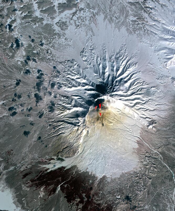
On Russia's remote Kamchatka Peninsula, a volcano that had sat quiet since roughly the year 1550 started erupting again in early August 2025 — and a radar satellite built jointly by NASA and India's space agency went on to record the lava flows, frame by frame, from December 2025 through mid-August 2026.
The satellite is NISAR (NASA-ISRO Synthetic Aperture Radar), and according to a release published by NASA's Jet Propulsion Laboratory on September 24, 2026, it has now assembled 17 radar images of Krasheninnikov volcano into a time-lapse sequence spanning December 25, 2025 through mid-August 2026. The result isn't a conventional video in the tourist-photo sense — it's a stack of radar reflectivity maps, each one a snapshot of how microwaves bounced off the mountain's slopes on a particular pass. Laid end to end, they trace the slow creep of fresh lava spreading from the volcano's northern crater, primarily eastward, with a second flow to the northwest that JPL says likely formed before NISAR's first observations.
An Eruption With a Blunt Trigger
The timeline here is hard to ignore. On July 30, 2025, a magnitude-8.8 earthquake struck the ocean off Kamchatka's Pacific coast. Days later, Krasheninnikov began erupting — which JPL describes as apparently triggered by the quake. JPL's release places the volcano's prior eruption at roughly 475 years earlier — long before satellites, long before seismology existed as a science.
JPL's own account is hedged on exactly how the quake and the eruption connect: it describes the volcano as "apparently" jolted awake, without spelling out the physical mechanism. What is clear is the timing — a major offshore earthquake, followed within days by a volcano's first eruption in centuries — and the timing is what makes the pairing hard to ignore.
How a Satellite "Sees" Lava at 464 Miles
NISAR doesn't work like an optical camera. It's a synthetic aperture radar instrument, meaning it sends down its own pulses of microwave energy and measures what bounces back, rather than waiting for sunlight to reflect off the ground. That makes it indifferent to cloud cover, volcanic ash plumes, or the fact that Kamchatka spends much of the year in darkness or fog — all conditions that would blind a visible-light imager trying to track an eruption in near-real time.
The spacecraft flies a sun-synchronous orbit at 464 miles (roughly 747 km) altitude on a 12-day repeat cycle, passing back over the same ground track twice each cycle — once heading south to north, once north to south — carrying a 39-foot radar reflector and dual-frequency instruments operating in both L-band and S-band. That combination lets it resolve surface features down to roughly 30 feet by 30 feet per pixel — coarse compared to a spy satellite, but more than fine enough to track a lava flow's leading edge advancing meter by meter, pass after pass, across the December 2025 to mid-August 2026 record.
Why It Matters
A single satellite image of a volcano is a curiosity. A consistent, repeating series is a monitoring tool — and that distinction is the actual news here. Cornell geophysicist Matthew Pritchard, quoted in the JPL release, put it plainly: "The consistency is crucial... this shows the promise of NISAR to closely monitor natural hazards." What NISAR adds is a consistent, all-weather, day-or-night record that doesn't depend on clear skies or daylight. A radar pass every 12 days turned this particular eruption, on a volcano with no recent eruptive history to compare against, into a documented, measurable event — lava flow extent, advance rate, and timing captured from orbit regardless of ash, cloud cover, or darkness.
That matters beyond Kamchatka. ISRO describes NISAR's mission as built to generate a dense time-series of data for monitoring geohazards and rapid environmental change worldwide, not just volcanic eruptions, and JPL frames the same repeat-pass approach as a way to track the development of natural hazards for both science and potential emergency response. An eruption tied to a major offshore earthquake, and tracked by the same mission from December 2025 onward, is a clean demonstration of that premise in practice.
The Data Behind the Pictures
NISAR isn't NASA's alone. It's a joint mission with the Indian Space Research Organisation (ISRO): JPL provided the satellite's L-band radar and its shared antenna reflector, while ISRO provided the spacecraft bus and the S-band radar. According to ISRO's own mission documentation, NISAR was in its science operations phase as of July 24, 2026, flying that same 747 km, 12-day repeat sun-synchronous orbit with a roughly 240 km imaging swath and a SweepSAR antenna architecture built around the shared 12-meter reflector. ISRO has begun releasing S-band data products — including standard radar imagery and interferometric products — to researchers through its Bhoonidhi data portal.
On the NASA side, the mission's L-band science data is being distributed through the Alaska Satellite Facility (ASF), a NASA Distributed Active Archive Center hosted at the University of Alaska Fairbanks. ASF confirms that NISAR's L-band data is now discoverable and downloadable through NASA's Earthdata Search system and ASF's own Vertex search tool — the access routes for the mission's L-band data.
None of this makes for dramatic viewing in the way a lava-fountain photo does. Radar backscatter imagery looks more like grainy grayscale topography than a glowing eruption. But that's arguably the point: the interesting part of the Krasheninnikov story isn't the volcano itself so much as the fact that a mission that ISRO describes as in its science operations phase as of July 2026 already produced a repeatable hazard record, running from December 2025 to mid-August 2026, of an event nobody could have scheduled in advance.
Sources
- US-India Satellite Captures Time-lapse Video of Volcanic Eruption — NASA/JPL
- NISAR S-Band SAR Data Products Release — ISRO
- Alaska Satellite Facility (ASF DAAC) — NASA/University of Alaska Fairbanks
Correction, Sept. 29, 2026: An earlier version of this article said NISAR was in position to watch the Krasheninnikov eruption begin and tracked it for eight months. JPL reports NISAR's first image of the volcano was on December 25, 2025, and the time-lapse runs from December 2025 through mid-August 2026. The article also no longer attributes to JPL statements about Kamchatka's ground monitoring or scientists' views on the quake link, nor describes the mission as a year into full operations. It also now says JPL likely places the northwest lava flow before NISAR's first observations.